Map depicts Cyprus, Rhodes and Western Thrace Within Turkish Borders
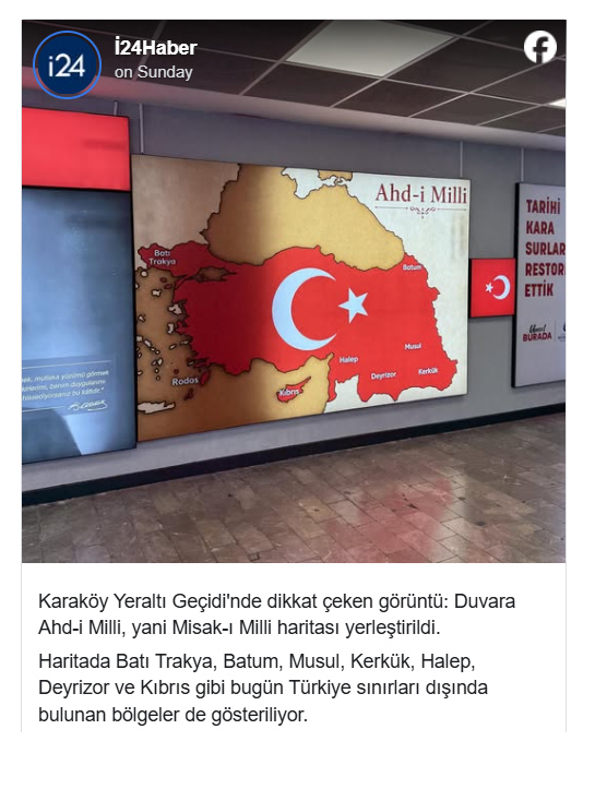
A map displayed in a busy underground passage in Constantinople has drawn attention for depicting Cyprus, Rhodes, other Greek islands and Western Thrace within a broader territorial area associated with Turkey’s historic “National Pact” ( Misak-ı Millî ).
The map is displayed in an underground passage in the Karaköy area of Beyoğlu, on the European side of Istanbul. It also includes territories extending into parts of present-day Syria, Iraq and Georgia.
Featuring a large crescent and star, the map bears the inscription “Ahd-i Millî,” another term associated with the Misak-ı Millî , or National Pact, adopted by the final Ottoman Parliament in 1920.
The installation presents Cyprus, Western Thrace and Rhodes in the same red-colored territorial space as Turkey, despite all three lying outside the borders of the modern Turkish state.
According to reports, the map was incorporated into the passage as part of its decorative and historical design and appears alongside an image of Mustafa Kemal Atatürk and inscriptions with nationalist themes.
Responsibility for the redevelopment of the passage has been attributed to the Technical Works Department of the Istanbul Metropolitan…