Challenging map in Constantinople with all of Cyprus occupied, islands and Thracetranslated
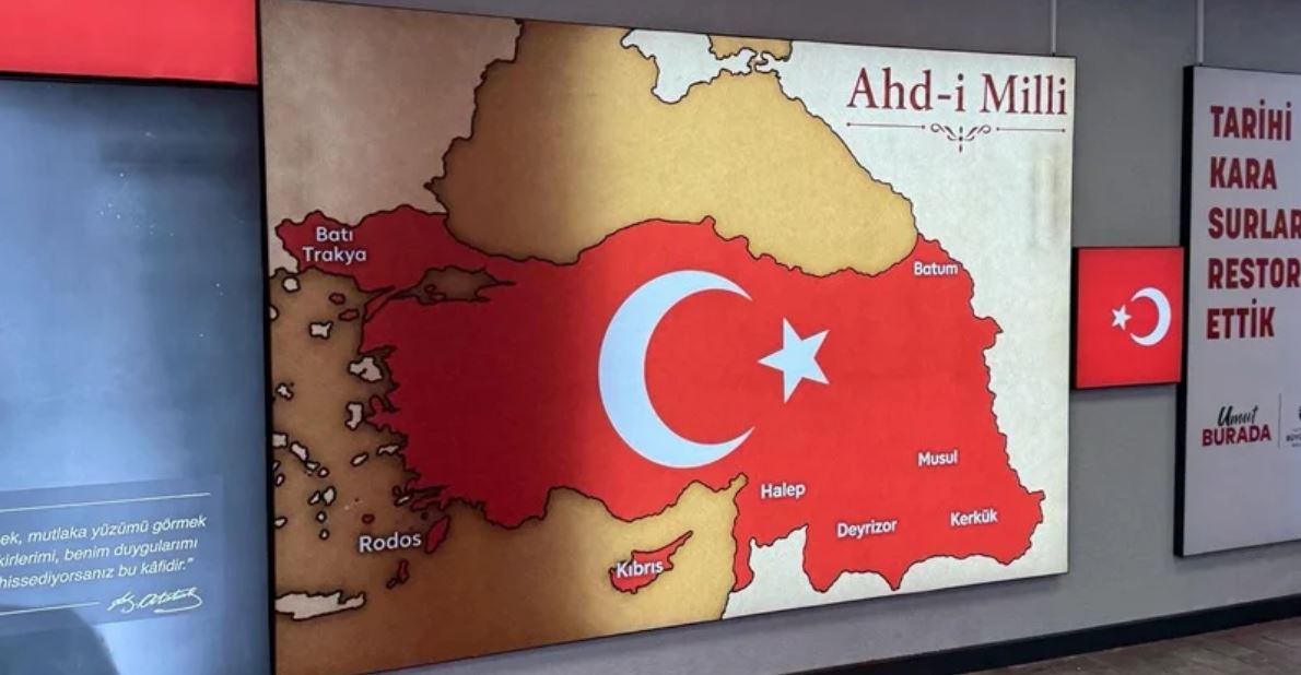
A provocative map was placed by the Turks in a busy underpass in the Karaköy district of Istanbul, showing all of Cyprus, Rhodes, other Greek islands, Western Thrace and part of Syria within the borders linked to the Turkish "National Oath". The map is located in an underground passage in Beyoğlu, in the European part of Istanbul, and refers to the territorial claims that were included in the decisions of the last Ottoman parliament in January 1920.
According to the publication, Turkish media reports that the map was included in the space as a decorative and ideological element. It has been placed next to a photo of Mustafa Kemal Atatürk and inscriptions with nationalist content.
The reconstruction of the underpass is attributed to the Directorate of Technical Works of the Metropolitan Municipality of Istanbul, which was allegedly responsible for the implementation and financing of the project.
Special mention is also made of the fact that the Municipality of Beyoglu has from time to time participated in programs financed by the European Union, among others in areas related to culture and climate change.
OR…